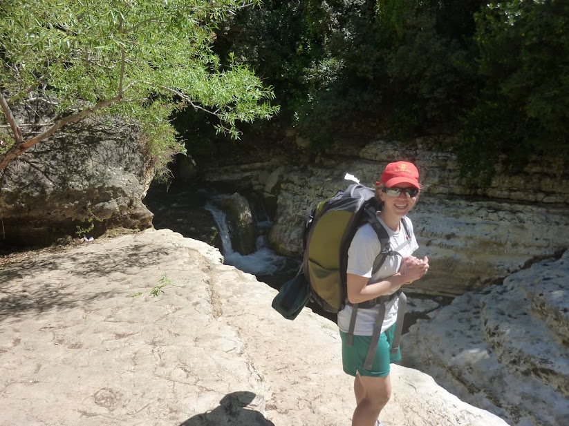
Though we didn't really know what we were getting into at the time, Caroline and I decided that we would do a 4-day trek from the Mediterranean Sea on the west side of Israel, to the Sea of Galilee on the east side of Israel. If you're thinking to yourself "that sounds hard" or "you guys might not be prepared for that" then you are correct.
The hike is called Yam el Yam, which means sea to sea. Hiking is very popular in Israel, and we thought this would be a good way to take part in the national pastime by hiking across the country - in the shorter direction. There is also an Israel National Trail that goes in the north-south direction, but that takes around 4-6 weeks so there was no chance we were going to do that.
There is so much to tell about experience. We learned a lot about hiking, a lot about preparation and planning, a lot about taking risks, a lot about Israel and a lot about ourselves and our relationship.
For some reason, during the hike I found myself making little mental lists, so I'm going to write about the trip that way. As always, we have a zillion pictures, more than we can post on the blog. If you want to browse through all the photos yourself, go here.
Top 5 things we were REALLY glad that we brought on the hike:
1. Enough food that we didn't worry.
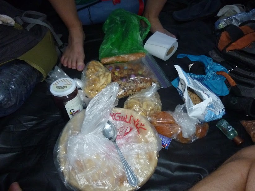
This is the food that we had at the end of Day 2. This might seem like a lot of extra weight, and at this point I thought so too. But on Day 3 we were very glad we had packed it. Day 3 was Friday, and we had aimed to make it to Tzfat before Shabbat started to buy more food. Unfortunately, we had taken a wrong trail earlier that day, and by the time we were close to Tzfat it was too late (Tzfat is a religious city so everything closes for Shabbat starting around 3pm). We camped out that night without replenishing our food supply, and while we weren't anywhere close to going hungry, let's just say we were quite sick of almonds by the time we found a place to buy food the next afternoon!
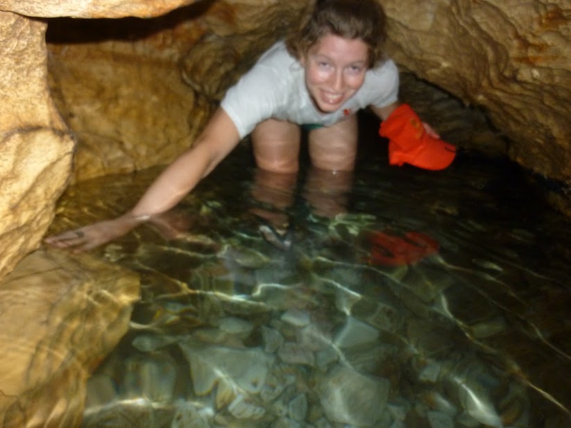
2. Head lamps
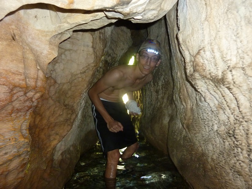
I think the absolute highlight of the hike was the Ein Tamir water tunnel that we explored mid-way through the first day. We arrived an area with lots of school groups bathing in the spring water pools, but luckily for us they left the coolest part alone. There was a narrow fissure in the rock on the side of one pool, and after squeezing through we found ourselves in a long, narrow tunnel with water up to our knees. It was slow going, but we made our way through twists and turns for about 20m or more. If we hadn't brought the headlamps, we never could have made it past the first turn because the light completely disappears. With the lights, it was an amazing experience to explore!
3. The map
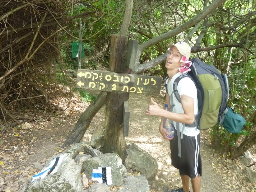
However, we sometimes needed to make a connection between two trails through an unmarked area, or we needed to find our way into and out of villages off the trail where we got food and water. This experience taught me that Google Maps might be pretty great, but sometimes a good old fashioned paper map is the best tool for the job. At plenty of times, Google Maps showed us standing in the middle of a big green area on the map with no markings at all, whereas our paper map showed details like little dirt paths, elevation changes, types of vegetation cover and more. This was a special hiking/terrain map from some outdoors-y organization in Israel. There are around 9 of them covering the whole country; we used map #2 for our trip covering the Upper Galilee.
4. Toilet Paper
I don't need to explain this one :) But we almost forgot to pack this and only remembered to grab a roll as we were walking out the door to start the trip. Phew!
5. The tent
The weather is really warm in Israel this time of year. Here in Haifa it's pretty steadily mid-80s during the day and right around 70 at night. A few people told us that because it is so warm, we could probably camp out in sleeping bags without the tent at night. We really considered it in order to save a little weight in our bags. I had once camped out on the bank of the Dead Sea with my brother with no tent, so it sounded reasonable.
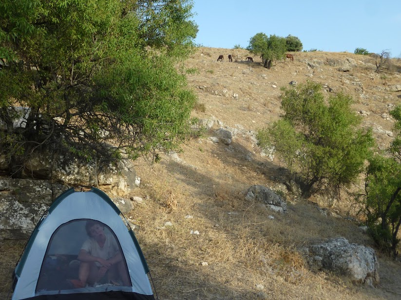
In the end, we decided to bring the tent, and THANK GOODNESS. Because we were hiking up into elevation, it was actually pretty cold the first two nights, to the point that I had to put on a few layers of dirty clothes in order to stay warm enough, even with a tent and a sleeping bag. It would have been really unpleasant without a tent.
Besides that, we also found ourselves up close and personal with a lot of animals during the hike, including this guy, who we found immediately outside our tent when we woke up on Day 4:

That's it for this list. I have a lot more list posts to write, including:
- Lessons we learned on the hike
- Best sights along the hike
- Most delicious things we ate
- Animals we saw or heard
And more!
No comments:
Post a Comment